By Township Canada
Township Canada Product Update - April 2026
April 2026: AER wells on the DLS map, Alberta CCS pore space tenure boundaries, and NTS parcel lookup by grid reference.
Here's what shipped in April 2026. This month was focused on Alberta energy data - specifically the two datasets that O&G professionals most often need to cross-reference against a DLS quarter section: licensed wells and CCS pore space tenure. We also extended the BC parcel API with NTS-based lookup.
Data & Maps
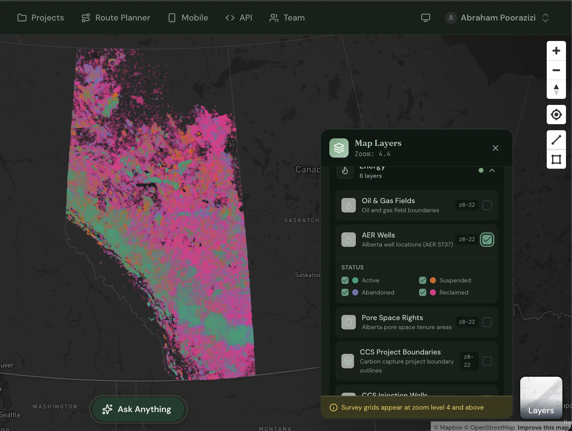
AER Wells Layer
Township Canada now displays 530,000+ Alberta Energy Regulator licensed wells as an interactive map layer on the DLS grid.
You can search by UWI (e.g., 100/06-32-048-07W5/00) or by LSD and the well appears as a pin against satellite imagery and the DLS survey grid. If you're doing surface lease review, field planning ahead of a site visit, or preparing an AER Directive 056 filing, this replaces the back-and-forth between OneStop and the converter.
Programmatic API access for well lookup by UWI or LSD - for data teams enriching permit tables or building field planning tools - is on our roadmap.
Available with the Energy Bundle (stacks on Pro or Business). Toggle the AER Wells layer from the map layers panel at townshipcanada.com/app. See /pricing for plan details.
Alberta CCS / Pore Space Tenure Layer
AER-licensed subsurface pore space tenure zone boundaries are now on the DLS grid map.
You can identify which quarter sections fall within or adjacent to a licensed CCS tenure area without cross-referencing the AER registry separately. Programmatic API access returning GeoJSON tenure-zone boundaries by LSD or quarter section - for the shapefiles AER CCS submission packages require - is on our roadmap.
If you're preparing a tenure proposal ahead of the AER CCS pore space tenure deadline on June 30, 2026, this layer gives you DLS-indexed tenure boundaries in the same view as your parcel data.
Free at all tiers. Toggle the CCS Tenure layer from the map layers panel.
Search & API
NTS Parcel Lookup
The ParcelMap BC layer now supports lookup by NTS grid reference in addition to GPS coordinates, PID, and PIN.
The new GET /api/parcels/nts endpoint returns all registered BC parcels whose centroids fall within a given NTS map sheet - with PID, plan number, area, centroid, and full boundary polygon (GeoJSON). It accepts the standard NTS map sheet identifier with or without separators - 093P/08, 093P-08, and 093P08 are all parsed the same way. The map sheet is the largest unit in the NTS hierarchy that British Columbia parcel records are reliably aligned to; higher-resolution references (block, unit, or quarter unit) such as A-2-F/93-P-8 should be resolved through the Search API instead.
This is useful in northeast BC, where resource permits and environmental reports often reference both an NTS map sheet and registered parcel boundaries. All three BC parcel endpoints (/nts, /lookup, /search) are now available on Pro plan and above.
What's Coming
- Pipeline ROW layer - Pipeline right-of-way boundaries are on the data layer roadmap, following wells and CCS tenure.
Industry Pulse
Esri ArcGIS Pro 3.7, now released, adds NATRF2022 coordinate systems but still has no native DLS/NTS locator. The Township Canada ArcGIS Pro toolbox remains the only way to resolve legal land descriptions inside ArcGIS Pro without switching applications.
The AER CCS pore space tenure proposal window closes June 30, 2026. If you're working on a tenure application, the CCS layer and its API endpoint are available now.
Questions or feedback? Write to hello@townshipcanada.com.