Real Estate add-on

Every quarter of a farm, in one client-ready package.

Draw the property or paste its legal land descriptions. Township Canada reads land use, soil and energy across every quarter and LSD, then builds a PDF package with your branding. Built for land brokers and rural appraisers.
$490
Per month, on Business
250
Quarter reports a month
9
Package pages to choose from
Aerial view pageLand profile pagePackage cover page
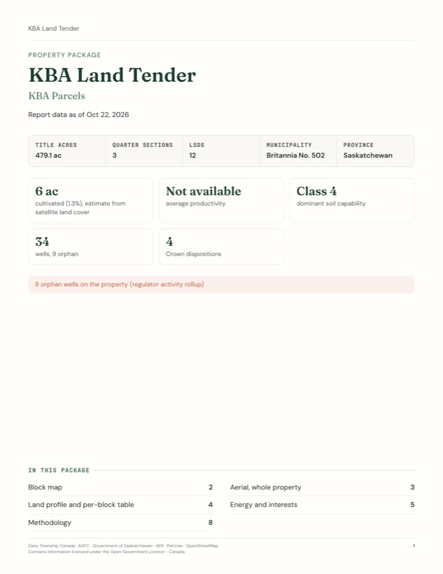
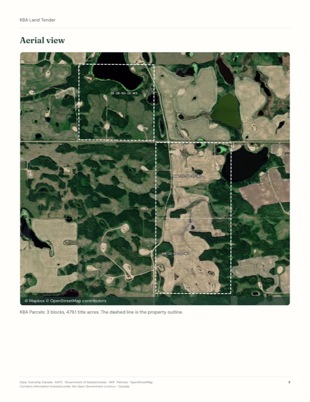
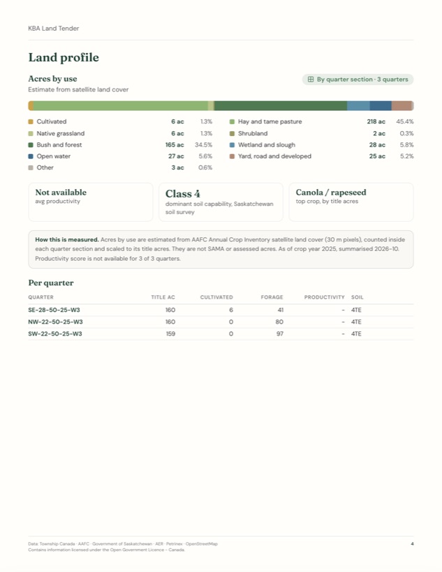
Sample package: KBA Parcels, 3 quarters, Britannia No. 502, SK
What's included

What a property package reads, for every block.

Land is read by quarter section and energy by LSD, so each figure says what it was measured over.

Acres by use
By quarter section
Cultivated, hay and pasture, native grassland, bush, wetland, water and yard acres for every quarter, estimated from AAFC satellite land cover and scaled to title acres.
Soil and productivity
By quarter section
Dominant soil capability for each quarter, plus the 0 to 100 productivity score for Alberta quarters.
Crops
By quarter section
The top crop by title acres and the crop mix across the property.
Wells and orphan wells
By LSD
Every well on the property's LSDs, with status and operator. Orphan wells are flagged at the top.
Pipelines and facilities
By LSD
Pipeline segments and facilities counted on each LSD of the property.
Crown dispositions
By disposition
Petroleum, natural gas and mineral dispositions that touch the property, with holders where the province publishes them.
Location and route
Per property
Where the land sits, and a driving route from a town you choose.
Aerial imagery
Per property and block
A satellite view of the whole property with its outline, plus one image per block.
How it works

From a drawn outline to a client package.

Properties live in your projects, so the whole team works from the same blocks and the same report.

  1. Define the property
    Draw the boundary on the map and it snaps to quarter sections, or paste quarters and LSDs from a title or listing. Business users can also turn a batch of results into a property.
  2. Run the report
    One run reads land and energy across every block. It counts one report per quarter, shown before you start, and running the same quarters again that month is free.
  3. Build the package
    Pick the pages, set a title and download the PDF, with your firm name and logo on every page. The maps and tables also come as PNG and CSV in one zip.
Package cover page with headline factsLand profile page with acres by use and a per-quarter tableAerial view page with the property outline
Cover, land profile and aerial pages from a sample package.
Who uses it

Three ways teams use a property package.

Land brokers

List a farm with the maps, acres by use and energy interests already done.

  • Block map and aerial for the listing
  • Acres by use for every quarter
  • Your firm name and logo on every page
  • PNG and CSV files for your listing site
Add Real Estate
Rural appraisers

Document the subject property quarter by quarter, with the method on the page.

  • Per-quarter land and soil table
  • Methodology with sources and dates
  • Wells and dispositions by LSD
  • One PDF for the appraisal file
See pricing
Farmland lenders and investors

Size up a multi-quarter farm before anyone drives out to it.

  • Acres by use and soil capability
  • Orphan wells and pipelines on the land
  • Location and route maps
  • Properties shared in a team project
Talk to sales
Pricing

The Real Estate add-on

Stacks on a Business subscription. $490 a month, or $4,900 a year.

Real Estate add-on
$490/mo add-on
Property packages, with your branding
For land brokers, rural appraisers and farmland teams. Includes Agriculture and Energy data.
  • Agriculture and Energy data, over whole properties
  • 250 quarter reports a month
  • Client PDF package with your firm name and logo
  • One aerial image per block
  • PNG and CSV downloads in one zip
  • Location, route and block maps
  • Methodology page with sources and dates
  • Replaces an Agriculture, Energy or combined add-on
On Pro? You can create properties today, and run reports with the Agriculture or Energy add-on. Branded packages, per-block aerials and the zip come with Real Estate on Business.
FAQ

Common questions

What counts as one report?
One quarter section in a calendar month. An LSD counts as the quarter it sits in. Running the same quarters again that month is free, and printing or downloading a package never counts.
Which provinces does it cover?
Properties are made of Dominion Land Survey quarters and LSDs in Alberta, Saskatchewan and Manitoba. Data depth varies by province: the productivity score is Alberta only, and Saskatchewan does not publish disposition holders.
Do I need a Business plan?
Yes, the Real Estate add-on stacks on Business. On Pro you can create properties, and with the Agriculture or Energy add-on you can run reports and print packages with the Township Canada credit. See plans.
Can I publish the package on a tender or listing site?
Yes. Package PDFs and images can be published, for example with a tender listing. Removing the "Township Canada" data credit or embedding live maps needs an Enterprise agreement.
Does it include ownership, title or sale comps?
No. Packages cover land, energy and location. Registered ownership, title and assessed values come from the provincial land titles office and the assessment authority, and every package says what it does not include.
Are the acres a survey or an assessment?
No. Acres by use are estimates from satellite land cover, scaled to title acres. They are not a survey and not assessed acres, and you can enter title acres yourself for any block.
What if we need more than 250 quarters a month?
Talk to us about Enterprise. Self-serve plans never bill overage.

Build your first property package.

Draw a farm or paste its legal land descriptions. Creating a property is free; reports count one per quarter.